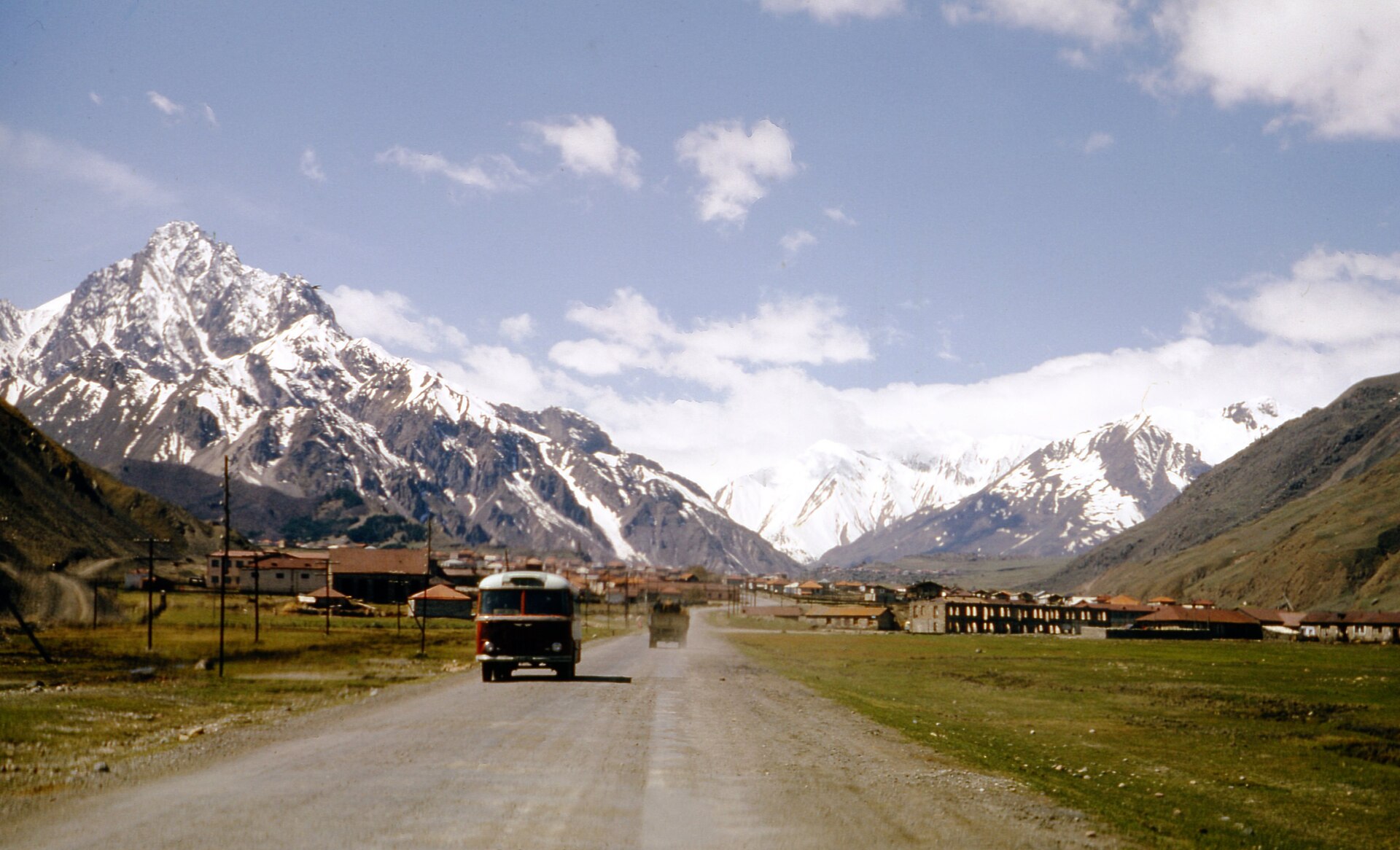
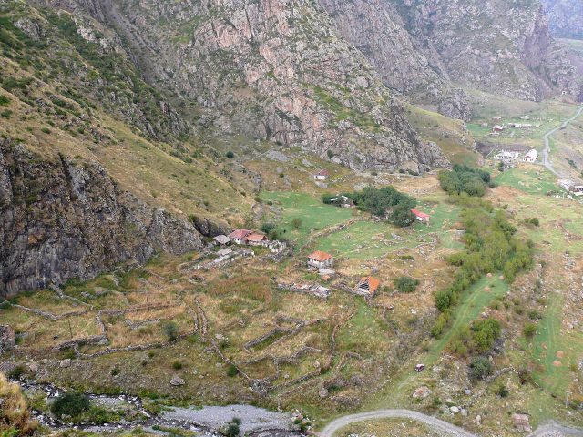
The Georgian Military Highway isn’t just a road cutting through the Caucasus Mountains—it’s one of the most breathtaking and historically layered routes in the world. Stretching between Tbilisi and Vladikavkaz, it winds through mountain passes, deep gorges, and ancient settlements, where every turn reveals something new: snow-capped peaks, rushing rivers, or medieval fortresses standing as if frozen in time. The journey covers roughly two hundred kilometers, and while modern travelers can drive it in a few hours, not so long ago, this trip took days or even weeks, depending on the weather and the state of the path.
The road’s origins trace back to antiquity, when it served as a vital trade route linking the South Caucasus with the North and, beyond that, Europe and Asia. Over the centuries, Georgians, Persians, Arabs, Mongols, and Russians all left their mark here. In the 18th century, after Georgia became part of the Russian Empire, the route gained strategic importance. Russian engineers and military forces transformed what was once little more than a rough trail into a proper highway capable of handling supply wagons and artillery. That’s how it earned its name—the Georgian Military Highway—though locals often simply call it the Georgian Road.
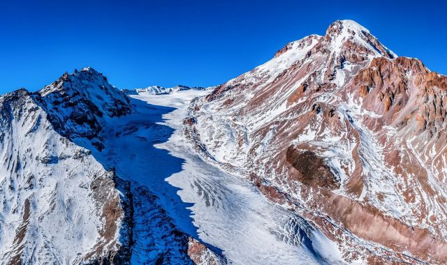
The most famous stretch begins just beyond Mtskheta, Georgia’s ancient capital, and continues to Stepantsminda, a small town nestled at the foot of Mount Kazbek. Here, the road climbs steeply, hugging cliffs and winding along the Terek River gorge. On clear days, the view of Kazbek—one of the Caucasus’ most photographed peaks, its glaciers glinting in the sunlight—is unforgettable. In winter, the slopes are blanketed in snow, making the drive treacherous but stunning: frost-laced trees, hairpin turns disappearing into the clouds, and the occasional car inching through the mist.
Along the way, several landmarks stand out, each with its own story. One of the most striking is the Ananuri fortress, built in the 16th and 17th centuries on the shores of the Jinvali Reservoir. This imposing structure, with its gray stone walls and towers, once guarded the approaches to the Aragvi Valley. Today, it’s a quiet place where visitors wander the ramparts, photograph the frescoed church, and admire the reflection of the fortress in the water. Just past Ananuri, the road curves sharply, revealing the reservoir—a man-made lake created during the Soviet era to power a hydroelectric station.
Further along, the highway leads to Jvari Monastery, perched on a cliff where the Aragvi and Mtkvari rivers meet. This site is steeped in legend: it’s said that in the 4th century, Saint Nino erected a cross here, marking the beginning of Christianity in Georgia. The monastery, built in the 6th century, seems to grow directly from the rock. From the viewpoint in front of it, the panorama of Mtskheta unfolds—domes of ancient cathedrals rising above green hills. On a clear day, the view stretches all the way to Tbilisi.
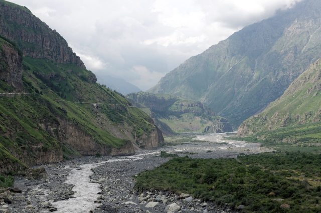
Beyond Jvari, the road climbs higher, and the landscape grows wilder. Vineyards and orchards give way to sheer cliffs and alpine meadows. At around two thousand meters above sea level lies the Jvari Pass, the highest point of the route. During the Soviet era, a massive cross was erected here, visible from miles away. In winter, the pass is often closed due to heavy snow, but in summer, travelers come to soak in the views and snap photos against the dramatic backdrop. The descent from the pass leads into the Darial Gorge, one of the narrowest and most spectacular sections of the highway. Here, towering cliffs squeeze the road on both sides, while the Terek River roars below, churning through rapids.
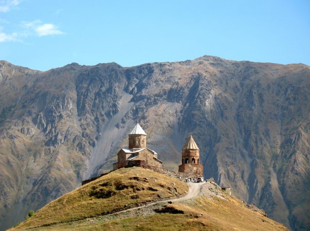
The Darial Gorge is woven into Georgian folklore and Russian literature. According to legend, this is where Prometheus was chained to the rocks for bringing fire to humanity. And when Alexander Pushkin traveled this road in 1829, he was so moved by the scenery that he penned lines that would become iconic: *The night mist lies on the hills of Georgia…* Today, the gorge looks much as it did two centuries ago—steep cliffs, the rush of the river, and the occasional village clinging to the slopes. In one such village, Gergeti, stands the Holy Trinity Church, a small 13th-century temple perched on a hill above Stepantsminda. From here, Kazbek looms so close it feels almost within reach.
Stepantsminda, the final stop on the route, is a quiet town of just a few thousand people. There’s no hustle of a big city here—life moves at the pace of the mountains. In summer, tourists arrive to hike to Kazbek’s glaciers or simply enjoy the crisp air and silence. In winter, the town becomes a base for skiers, though the facilities are modest compared to European resorts. At the center of Stepantsminda stands a monument to Pushkin, a reminder that this road has inspired not just travelers, but poets as well.
The Georgian Military Highway is more than just a road. It’s a living chronicle, where every stone and every bend tells a story. Here, the fates of nations intertwine, eras come and go, but the mountains remain unchanged, watching the world shift at their feet. Driving this route, it’s impossible not to wonder how many people have passed this way before—merchants, soldiers, pilgrims, poets. And how many more will follow, because the Caucasus will always draw those in search of beauty, adventure, and inspiration.