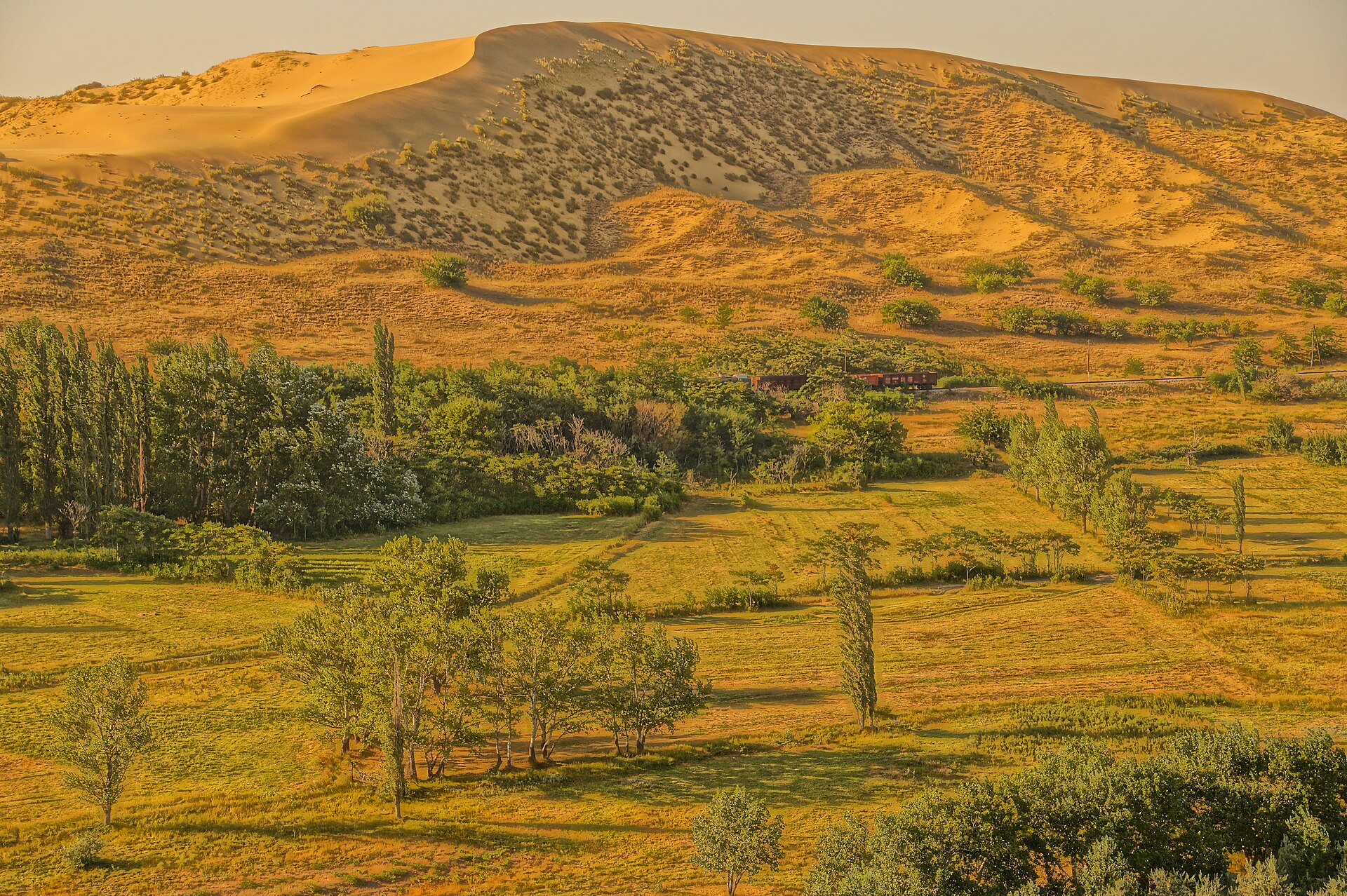
Sarykum is a sand massif in the Kumtorkalinsky District of Dagestan, at the foot of the Narat-Tyube ridge, 16–18 km north-west of Makhachkala. It is usually called a barchan, but it is not a single dune: it is a system of dunes covering more than 2,500 hectares, 11–12 km long and over 3 km wide. The massif is part of the Dagestansky Nature Reserve.
The summit rises 175–185 m above the floodplain of the Shura-Ozen River and about 245 m above sea level, according to a 2014 measurement by the geomorphologist A. Gusarov; the reserve's website gives 242–245 m. The often-quoted 262 m is the elevation on a late-19th-century map, not today's height: on the 1954 map the summit stood at 251.5 m. So the top has become lower over a century or so, although how accurate the old map was is unknown. The wind reshapes the crests, but the bases of the dunes stay where they are.
Gusarov calls Sarykum the largest in Russia and one of the highest in Eurasia among isolated sand massifs, meaning those that lie far from any desert. It can be called the highest in Europe only if Europe's border is drawn along the Main Caucasus Ridge; the next in line is then the Dune of Pilat in France, about 100 m high. If the border follows the Kuma-Manych Depression, Dagestan lies in Asia. World records are another matter: the highest dunes, in China's Badain Jaran Desert, reach 460–480 m.
Where the sand came from is still not established. There are several hypotheses: weathering of local sandstones, sand carried across the Caspian from the Karakum, deposits of the Shura-Ozen delta. A scientific paper from 2015 still calls the massif's origin a great mystery.
Visitors see the dune from the Wonders of Sarykum eco-trail: about 800 m up the slope to one of the summits, with two viewing platforms and information boards along the way. Nearby are a visitor centre with a museum, entry 200 roubles, and guest houses. This is a nature reserve, so leaving the trail is not allowed, and campfires, barbecues, tents and drones are banned.
By car from Makhachkala, head north-west on the R-217 Kavkaz highway, turn left after the bridge over the Shura-Ozen and drive about 4.5 km on a gravel road to the car park. Without a car, take a minibus from the Northern Bus Station towards Kizilyurt or Khasavyurt, get off at the turn and walk the same 4.5 km.
From May to September the average monthly air temperature is above +20 °C, and the sand on the southern slopes heats up to +60 °C and more. In summer it is best to climb in the morning or towards sunset; spring and autumn are milder.