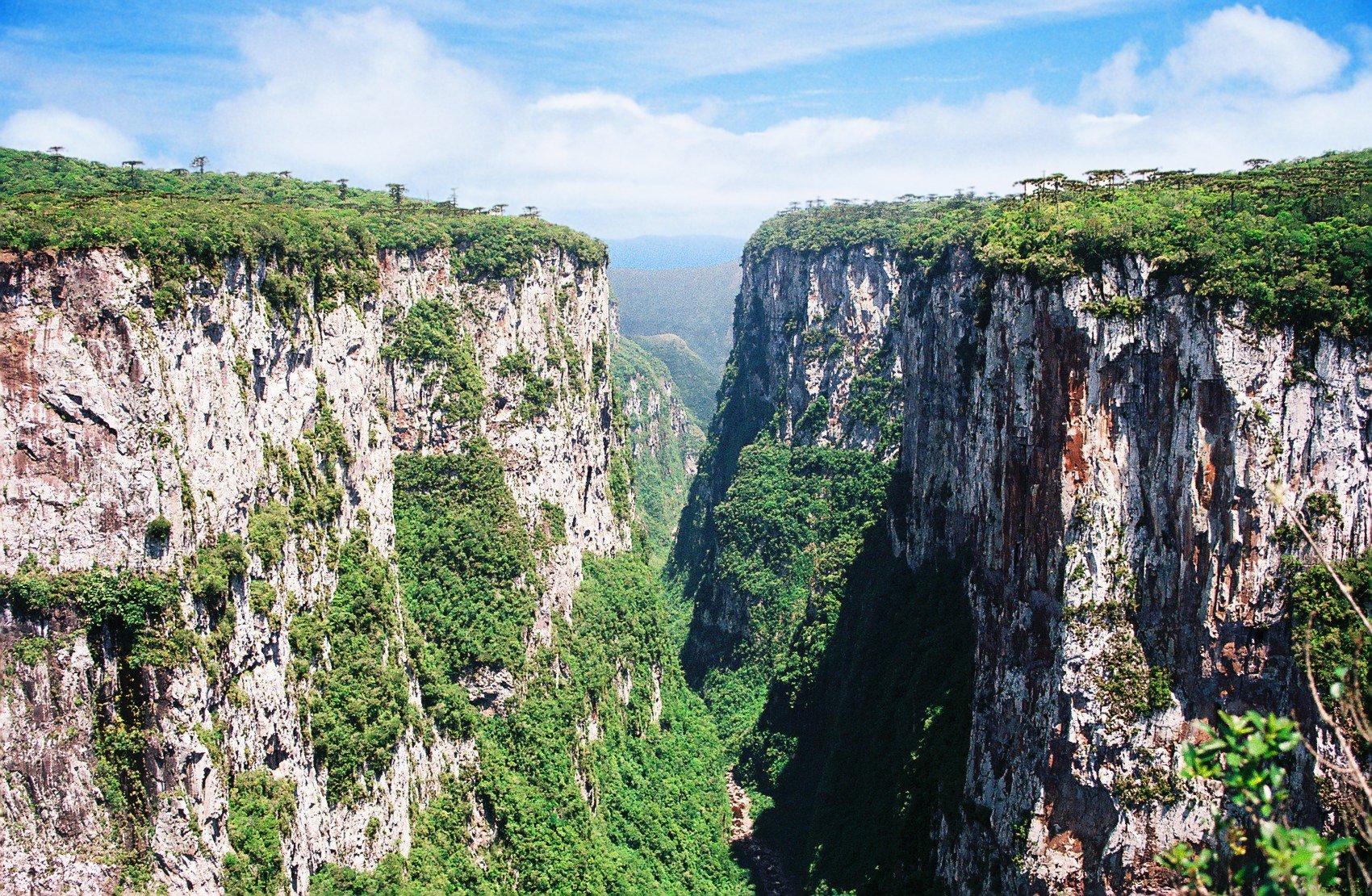
Aparados da Serra National Park lies in the southern reaches of Brazil, straddling the border between Santa Catarina and Rio Grande do Sul. This is not the Brazil of postcards—no swaying palms, no sun-bleached beaches. Instead, the landscape unfolds in cool highland plateaus, sheer canyons, and waterfalls plunging from towering cliffs. The park covers over sixteen thousand hectares, its terrain more reminiscent of the Andes than the tropical lowlands most associate with the country. The name itself, meaning "mountain cliffs," hints at the dramatic drops where forested walls plunge hundreds of meters into the earth.
The park’s origins trace back to the mid-20th century, when it became clear that this corner of Brazil needed protection. In 1959, Aparados da Serra was designated a national park, preserving patches of araucaria forests—ecosystems that once blanketed much of southern Brazil. The araucaria, or Brazilian pine, with its sprawling branches and massive cones, remains a symbol of the region. These forests shelter rare wildlife, including pumas, ocelots, and several species of sloths, though sightings are rare. The animals here move on their own terms, untouched by the crowds that flock to more famous reserves.
The crown jewel of the park is Itaimbezinho Canyon, one of the deepest in Brazil. Its walls rise as high as seven hundred meters in places, stretching over five kilometers in length. During the rainy season, a river carves through the canyon floor, feeding cascading waterfalls. The most famous, Véu da Noiva—or "Bridal Veil"—earns its name from the delicate sheet of water that spills over the cliff’s edge. In drier months, the falls thin to a whisper, but the canyon’s grandeur remains undiminished. Viewing platforms perched on the rim offer dizzying glimpses into the abyss below.
The weather here is as unpredictable as the terrain. Even in summer, the air stays cool, and mornings often arrive shrouded in mist. Winter can bring frost to the plateaus, with temperatures occasionally dipping below freezing. A single day might shift from sunshine to downpour and back again, so layers and waterproof gear are essential. The damp seeps into everything, and the chill lingers long after the rain stops.
Hiking is the best way to explore, though the trails demand stamina. The most popular route leads to Itaimbezinho Canyon, a two-hour trek one way from the park entrance. The path winds through forests, climbing and descending with the land. Signs along the way point out local flora and fauna, though the real reward is the silence and the sense of isolation. For those willing to venture further, multi-day treks to other canyons and waterfalls exist, but they require permits and a guide.
Unlike Brazil’s more tourist-heavy parks, Aparados da Serra offers solitude. Even on weekends, it’s possible to find trails empty of other visitors. The local communities, many with roots in the gaucho tradition, treat the park with reverence. For generations, families have lived in harmony with the land, some now offering homestays or guided tours. Their connection to the place runs deep, shaped by a way of life that has long depended on the rhythms of nature.
This is a different side of Brazil—one without crowded beaches or resort towns. The air smells of damp earth and pine, and the only sounds are the wind through the trees and the distant rush of water. It’s a place for those who seek not entertainment, but something quieter, something that lingers. The effort it takes to reach these heights is part of the experience. In a country where wild spaces are increasingly rare, Aparados da Serra feels like a glimpse of what Brazil once was.